
09 Aug 2026
Ma Pi Leng Pass: The Complete Guide to Ha Giang's Iconic Road
Ma Pi Leng PassHa Giang LoopNho Que RiverDong Van GeoparkSafety
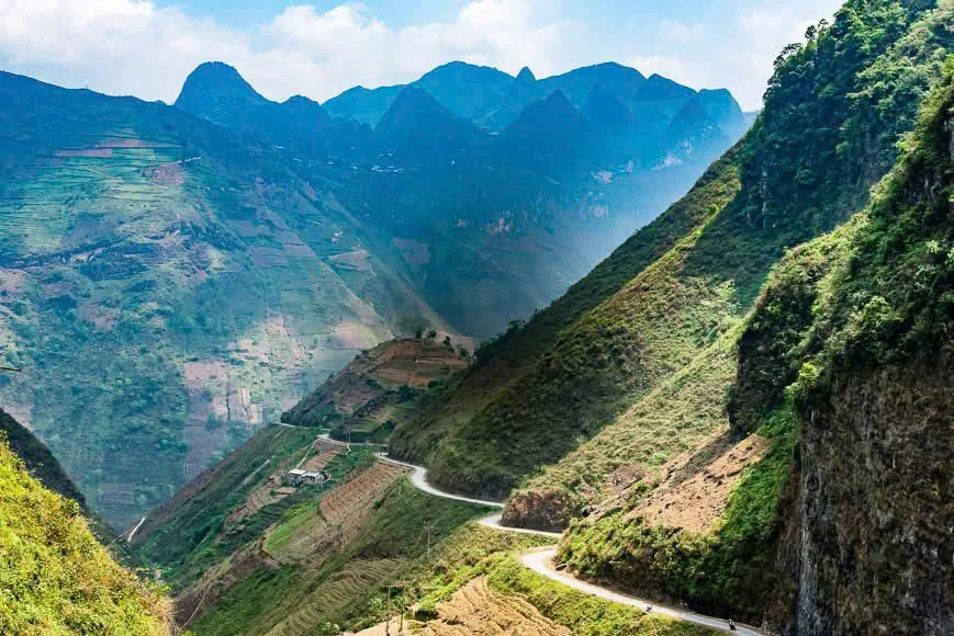
Ask anyone who has finished the Ha Giang Loop which stretch they would ride again tomorrow and the answer is almost always the same: Ma Pi Leng. Around twenty kilometres of tarmac cut into a cliff between Dong Van and Meo Vac, with the Nho Que River a green thread far below. We ride it every week, and we still stop.
Quick Facts Before You Go
- Where: on national road QL4C between the towns of Dong Van and Meo Vac, Ha Giang province, close to the Chinese border.
- Height: the road tops out at roughly 1,200 metres above sea level; the peaks around it climb higher.
- Protected area: inside the Dong Van Karst Plateau, Vietnam's first UNESCO Global Geopark.
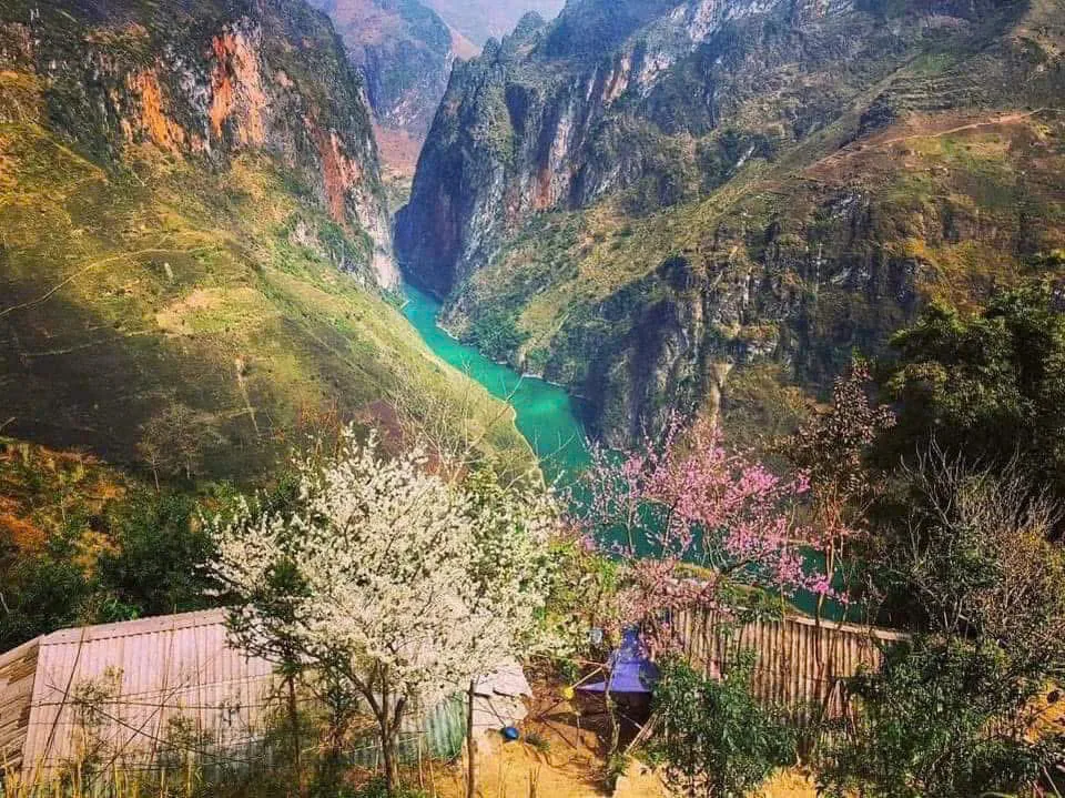
- Below the road: the Nho Que River and Tu San canyon, the deepest gorge in the region.
- Distance Dong Van to Meo Vac: about 24 kilometres, which sounds like forty minutes and usually takes us half a morning.
- How Freedom rides it: Easy Rider behind a local driver, self-riding with a valid licence, or a seat behind a friend. Always slowly.
Why Ma Pi Leng Is So Famous
Three landscapes collide here. Limestone peaks stack up on one side, sharp and grey. On the other the ground simply disappears, dropping hundreds of metres to the river. And the river itself, milky jade in the dry season, deeper green after rain, snakes through the bottom of the gorge as if drawn with a fine brush.
What photographs never quite catch is that the view moves. One bend gives you the canyon, the next a wall of rock, the next a valley of corn terraces with a H'mong hamlet clinging to the slope. Ten minutes later the cloud rolls in and there is nothing but white and the sound of your engine. Then it clears again. That constant reframing is why the pass never gets old for us.
The Story Behind the Happiness Road
Ma Pi Leng belongs to the Happiness Road, the highway that first connected Ha Giang city with the rocky plateau of Dong Van and Meo Vac. Before it existed, the northern districts were reachable only by mule track, and salt, rice and medicine came up on people's backs.
Construction started at the end of the 1950s and took the better part of six years, carried out largely by hand by young volunteers from many provinces and by the local H'mong, Tay and Lo Lo communities. The Ma Pi Leng section was the hardest part: workers hung from ropes on the cliff face to chisel the ledge you now ride on, and it took close to a year to open this short stretch alone. Some of them did not come home. A memorial near the highest viewpoint remembers them, and we always stop there.
Knowing this changes how the road feels under your wheels. The curves are not just scenery; they are the result of people cutting rock with hand tools so that their children could get to a hospital.
What You Can See From the Pass
The classic stops, in the order we reach them riding from Dong Van:
- The first cliff balconies. Just past the top, small pull-outs where the whole gorge opens up for the first time.
- The Ma Pi Leng viewpoint and memorial. The highest and busiest stop, with the plaque to the road builders and the widest panorama over the Nho Que.
- The M slope. A section of road that folds back on itself in the shape of a letter M when seen from above. It is in every Loop photo for a reason.
- The sky path (Vach Da Trang). A narrow walking trail along the white cliff off the main road, for anyone who wants twenty minutes on foot with nothing but air on one side.
Clear days show the scale; the mountain layers go on until they fade into China. Misty days hide most of it but feel like riding inside a Chinese ink painting. Neither is better. Just keep your camera ready and your bike parked in a proper pull-out, not on a blind corner.
The Nho Que River and Tu San Canyon Below
The pass gives you the view from above. The river gives you the opposite one.
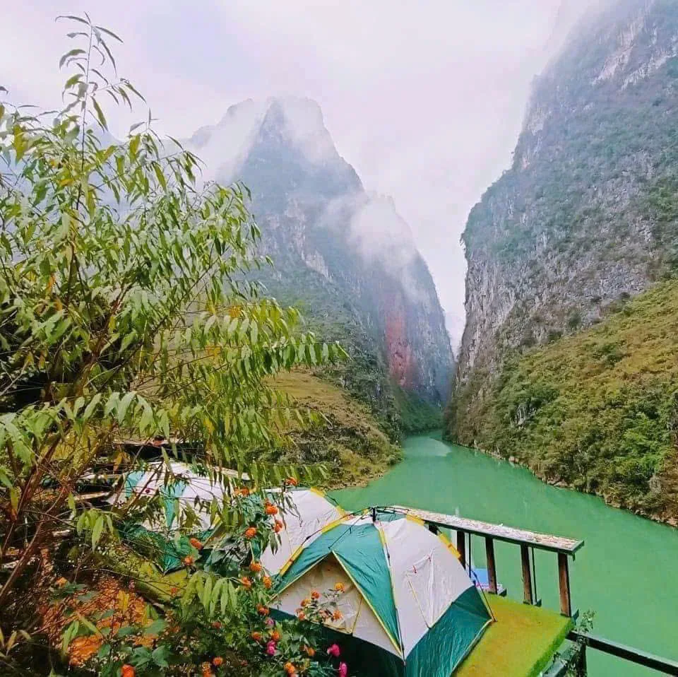
A side road drops from the pass to the boat piers on the Nho Que, where local boats motor upstream into Tu San canyon. Down on the water the walls close in on both sides, several hundred metres of vertical limestone, and the road you were standing on half an hour earlier becomes a scratch near the sky. If you have time, do both. From the top you understand the geography; from the bottom you understand the size.
On our 3-day and 4-day Loops the river and the pass fall on the same afternoon, after the Meo Vac viewpoint and the bamboo forest.
Best Time to Ride Ma Pi Leng
- Spring (February to April): mild, mostly clear, blossom in the villages. Good visibility on the pass.
- Summer (May to August): the greenest months and the wettest. Rain makes the road slippery and cloud can sit on the pass for hours; we adjust timing around it.
- Autumn (September to November): our favourite. Harvest gold in September, then buckwheat flowers covering the Dong Van plateau in pink and white through October and November, usually under dry skies.
- Winter (December to January): cold and frequently foggy up high. Atmospheric, sometimes bitterly so. Gloves are not optional.
No month is guaranteed. Mountain weather changes by the hour, and the best plan is a flexible one.
Where It Fits on the Ha Giang Loop
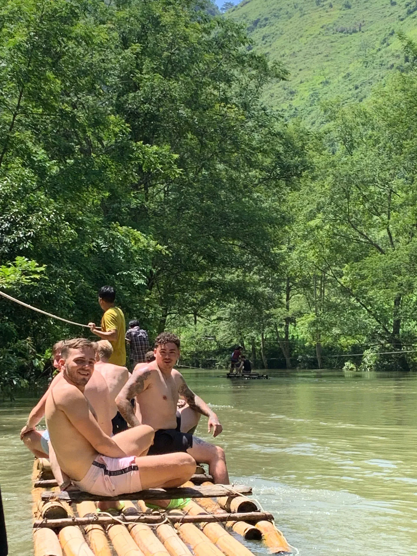
Ma Pi Leng sits in the middle of the Loop, between Dong Van and Meo Vac. On our 2-day express Loop it is the morning of day two. On the 3-day and 4-day Loops we approach from the quieter Du Gia side and reach it on the afternoon of day two, after rafting on the Hangtham Lin River in the morning, before sleeping with a H'mong family in Dong Van.
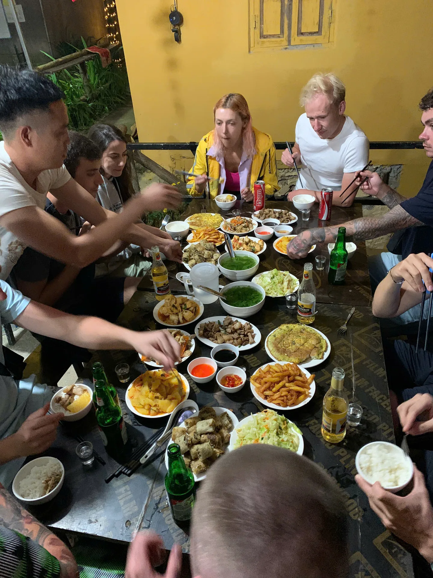
Twenty-four kilometres should take under an hour. With our stops it takes two to three. That is deliberate; nobody rides all the way to Ha Giang to hurry the best part.
Easy Rider or Self-Ride?
We offer two ways to sit on a bike here, plus a third option for friends.
Easy Rider means you sit behind a local driver who has ridden this pass hundreds of times, and you spend the whole road looking at the view instead of the tarmac. No licence needed. This is what we recommend for anyone without solid manual-bike experience.
Self-riding is available on our 3-day and 4-day Loops if you hold an International Driving Permit under the 1968 convention (category A or A1) together with your national licence. Police checkpoints on the Loop ask for both, and so do we. Renting a bike somewhere is not the same as being legal to ride it, and an accident without a valid licence usually means an invalid insurance claim as well.
Seat behind a friend lets you share a bike with a companion who books the self-riding option, at a lower price.
The Loop, for us, is a motorbike road, and two wheels is the only way we offer it.
Safety and Responsible Travel on the Pass
- Stop only in marked pull-outs and viewpoints, never in the lane on a bend.
- Do not climb over barriers or onto loose rock for a photo. The drop is real.
- Ride in your lane. Trucks and buses use the full width on corners.
- In fog, slow right down, lights on, and follow the guide's rear light.
- Wet limestone dust is like ice; brake early and gently.
- Take your rubbish back to town, ask before photographing local people, leave rocks and plants where they are, and buy your coffee at the family stalls on the viewpoints.
Conclusion
Ma Pi Leng is memorable because geology, history and human effort meet on one ledge of road. A river below, a canyon carved through the plateau, a highway built by hand, and a UNESCO geopark all around it. Ride it slowly, stop often, and look down at least once at how small the road is against the mountain.
Frequently Asked Questions
Where is Ma Pi Leng Pass?
On the QL4C road between Dong Van and Meo Vac in Ha Giang province, inside the Dong Van Karst Plateau UNESCO Global Geopark.
What altitude does the road reach?
Around 1,200 metres at the road's highest point.
How long does Dong Van to Meo Vac take?
Roughly 24 kilometres; forty minutes without stopping, half a morning the way we ride it.
Can beginners ride it?
Beginners should sit behind a local driver. Self-riding is for experienced, licensed riders only.
Is the Nho Que River close to the pass?
Yes. It runs directly beneath the road, and a side road leads down to the boat piers.
Ride Ma Pi Leng With Freedom
All three of our Loops cross the pass, with the 3-day and 4-day routes adding the Nho Que River and the Du Gia side. Compare them on our pricing page or message us on WhatsApp at +84 973 910 970 and we will help you choose.
More stories
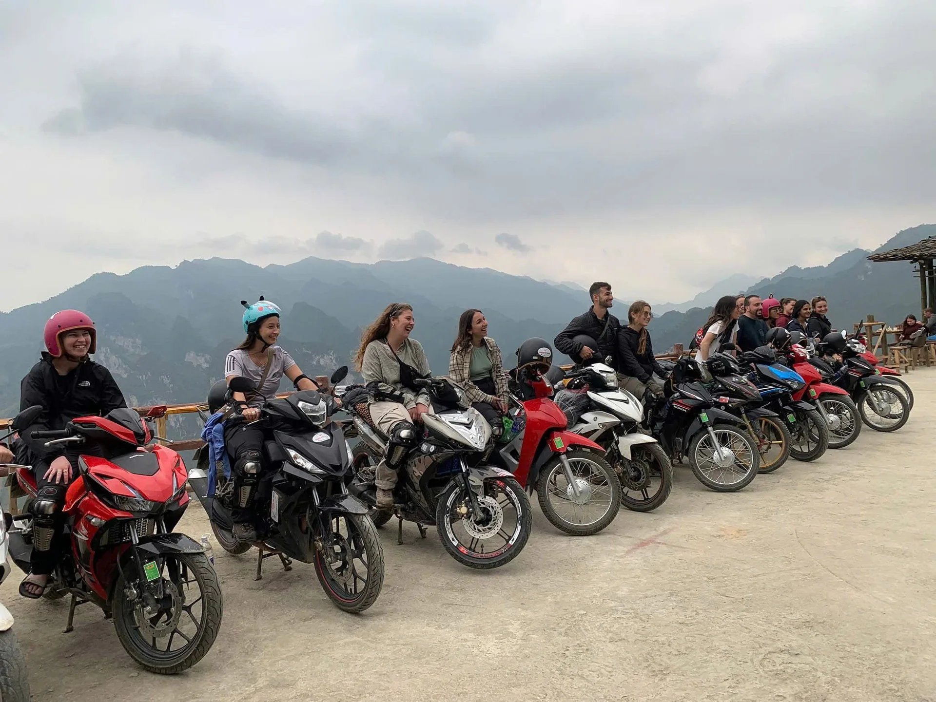
10 Aug 2026
Freedom Ha Giang Loop: Why Ride Vietnam's Mountain Road With Us
What a Ha Giang Loop with Freedom actually looks like: three ways to ride, small groups with their own guide, family homestays, proper gear, pick-up from Hanoi and a safety-first pace.
Read more →10 Aug 2026
Ha Giang Loop Adventures: A Complete Guide to Riding Northern Vietnam
Everything we tell our own guests before they ride the Ha Giang Loop: the route through the Dong Van Geopark, Ma Pi Leng and the Nho Que River, the people along the road, how many days to take, and whether to ride yourself or sit behind a local Easy Rider.
Read more →
10 Aug 2026
Ha Giang Loop Deaths: The Safety Facts to Know Before You Ride
People do die on the Ha Giang Loop, and pretending otherwise helps nobody. Here is what actually goes wrong on these mountain roads, what the licence law says, and how to pick a way of riding that brings you home.
Read more →